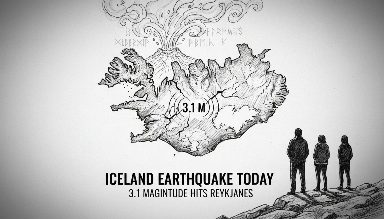
Iceland earthquake activity continued overnight with a magnitude 3.1 tremor near Kleifarvatn lake. The quake struck at 1:48 AM local time, shaking the Reykjanes Peninsula south of the capital. The Icelandic Meteorological Office confirmed several smaller aftershocks followed the main event. Residents in Hafnarfjörður, a town of 30,000, reported feeling the seismic event.
This incident highlights the constant geological restlessness defining Iceland's existence. The country sits directly atop the Mid-Atlantic Ridge, where the North American and Eurasian tectonic plates diverge. Earthquakes here are not anomalies but daily geological punctuation. Thousands are detected annually, though most are too faint for human perception.
"A magnitude 3.1 earthquake is a minor event in our context, but it is a clear signal," said Dr. Elín Björnsdóttir, a seismologist with the Met Office. "The Reykjanes Peninsula remains in an active phase. Each tremor, however small, adds data to our models and reminds us of the forces beneath our feet."
The Geology of a Restless Peninsula
The Reykjanes Peninsula is a geological hotspot within a hotspot. The region has experienced periods of significant seismic and volcanic unrest in recent years, including the 2021 eruption at Fagradalsfjall and subsequent activity. Kleifarvatn itself, the largest lake on the peninsula, is a product of this volatile landscape. Its 97-meter depth is a testament to the tectonic forces that shape the area.
Earthquakes here are primarily caused by the plates pulling apart. As tension builds and releases along fault lines, the ground shakes. The magnitude 3.1 event near Kleifarvatn is a typical expression of this ongoing process. It is far from the record—Iceland's largest recorded quake was a magnitude 7.0—but it fits into the persistent background hum of activity.
Monitoring is continuous and comprehensive. A dense network of sensors across the peninsula feeds data to the Icelandic Meteorological Office around the clock. This allows for real-time tracking of seismic swarms, which can sometimes precede volcanic eruptions. The data from last night's event will be analyzed to understand its precise fault source and its relationship to the broader tectonic stress field.
From Data Points to Daily Life
For seismologists, the event is a data point. For residents of Hafnarfjörður and the broader capital region, it was a physical reminder. Reports of the tremor being felt there underscore how urban development in Iceland exists in direct conversation with powerful natural forces. Reykjavík and its neighboring municipalities are built on this active terrain.
Iceland's building codes are among the strictest in the world regarding earthquake resilience. Structures are engineered to withstand significant shaking, a non-negotiable requirement for a nation on the ridge. This regulatory framework transforms scientific understanding into practical safety. Last night's tremor was a minor test of that infrastructure, one it was built to pass effortlessly.
"We felt a single, sharp jolt," said Anna Þórsdóttir, a resident of Hafnarfjörður's Hvaleyrarholt district. "It's brief, but it always makes you pause. You remember where you live. Then you check the Met Office website, see it was small, and go back to sleep." This routine reaction illustrates the public's educated coexistence with seismic risk, fostered by transparent information flow from authorities.
The Nordic Context of Crisis Preparedness
Iceland's experience with seismic monitoring and public alertness offers a model for its Nordic neighbors, though their geological threats differ. Norway monitors for landslides, Sweden for flooding, and Finland for extreme cold. The shared Nordic principle is proactive, science-based hazard management. Cooperation through the Nordic Council of Ministers often focuses on sharing best practices in civil protection and environmental monitoring.
Iceland's Met Office operates as a central nerve center, similar to how the Swedish Meteorological and Hydrological Institute (SMHI) or the Norwegian Water Resources and Energy Directorate (NVE) function in their domains. The immediate public trust in the Met Office's reports following the Kleifarvatn quake is a key component of societal resilience. It prevents misinformation and aligns public perception with scientific reality.
This event, while minor, occurs as Nordic nations increasingly coordinate on climate-related and geological hazards. The changing Arctic environment is a shared concern. Iceland's granular data on plate tectonics contributes to a broader understanding of North Atlantic geology, which can inform risk assessments from Greenland to Norway.
Beyond the Tremor: Environmental and Economic Echoes
No damage or injuries were reported from this earthquake. Its immediate impact was negligible. However, sustained seismic activity on the Reykjanes Peninsula carries longer-term environmental and economic considerations. The region is critical for Iceland's geothermal energy sector, which provides over 25% of the nation's electricity and heats nearly 90% of its homes.
Geothermal plants, like those at Svartsengi near the Blue Lagoon, are engineered for seismic activity. But ongoing tremors can alter subsurface hydrothermal systems. Monitoring these changes is essential for maintaining energy output and infrastructure integrity. The fishing industry, another economic pillar, is less directly affected by small quakes, though major port infrastructure in towns like Hafnarfjörður is also built to strict seismic codes.
From an environmental perspective, earthquakes can alter groundwater flow and lake systems. Kleifarvatn itself has a history of fluctuating water levels, partially linked to seismic activity. In 2000, a major earthquake swarm on the peninsula opened fissures that caused the lake level to drop significantly over several years. Each new tremor prompts scientists to check for any such hydrological effects.
A Persistent Dialogue with the Planet
The Kleifarvatn earthquake is not a headline-grabbing disaster. It is a sentence in the ongoing dialogue between Iceland and the subterranean forces that created it. This dialogue is measured, monitored, and managed. It informs urban planning in Reykjavík's new neighborhoods, guides the operations of the geothermal sector in Reykjanes, and shapes the public consciousness.
For visitors, Iceland's geology is a spectacle of geysers and volcanoes. For residents, it is a daily reality of occasional shakes and relentless monitoring. The country has turned a fundamental geological vulnerability into a realm of expert knowledge and resilient design. The response to a 3.1 magnitude quake is now routine: detect, analyze, inform, and file.
As the plates continue their slow, inevitable separation, more tremors are guaranteed. The system held. The data was collected. The public was informed. In Iceland, this is not news of crisis, but a report on the steady state of a living landscape. The true story is not that the earth moved, but how seamlessly the society above it adapted to that perpetual motion.