Iceland weather forecasts from the Icelandic Meteorological Office warn of a sharp drop in temperatures and strengthening winds across the country. A widespread frost is expected in the northeast tonight, with temperatures plunging to around freezing in eastern regions. The forecast outlines a shift from today's milder west winds to stronger, potentially hazardous conditions by Tuesday evening.
This incoming weather pattern is a classic Icelandic transition, moving from manageable conditions to a more challenging environment within 48 hours. For residents and travelers, it underscores the non-negotiable rule: always check the forecast, and then check it again. The Veðurstofa Íslands has detailed a multi-day progression that will test preparedness across different regions.
From Mild West Winds to a Northern Bite
Today's conditions offer a deceptive calm before a more active pattern takes hold. West winds of 3 to 10 meters per second are prevailing, though stronger gusts are hitting the northeast and east initially. The country is mostly cloudy with sporadic rain, though the Southeast and the dramatic fjords of the Eastfjords will remain dry. Temperatures are currently in a modest range of 1 to 7 degrees Celsius.
However, the focus for tonight is squarely on the northeast. "Frystir allvíða norðaustantil í kvöld," the forecast states clearly—frost is expected widely in the northeast tonight. This early-season cold snap serves as a sharp reminder of Iceland's proximity to the Arctic, even during transitional seasons. Agricultural interests in regions like Mývatnssveit and Þingeyjarsýsla will be noting this development closely.
A Nation Divided: Showers West, Clearing East
Tuesday presents a picture of a country split by weather. Southwest winds of 5 to 13 meters per second will blow north of the highlands, with lighter air elsewhere. The western and northern parts of the island, including the capital region of Reykjavík, can expect cloudy skies with occasional showers or even sleet—a messy mix of rain and snow.
Conversely, the eastern part of the country, from the Eastfjords down to the Vatnajökull region, will see brighter conditions with sunny spells. The trade-off is a significant temperature drop, with thermometers hovering around the freezing mark. This east-west divide is a common feature in Icelandic meteorology, often dictated by the precise positioning of low-pressure systems and the sheltering effect of the central highlands.
The Wind Rises: A Hazardous Tuesday Evening
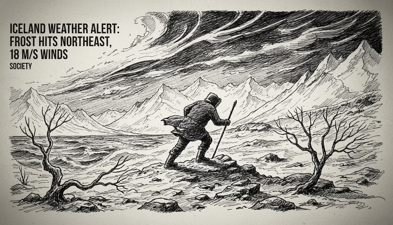
The most significant development in this forecast sequence is the strengthening wind expected by Tuesday evening. What begins as a day of variable breezes will transform into a blustery and potentially dangerous situation. Forecasters predict west winds will increase to 10 to 18 meters per second by Tuesday night.
This is not just a statistic; it represents a tangible shift into a higher risk category for travel and outdoor activity. A wind speed of 18 m/s is approximately 40 miles per hour, strong enough to impact vehicle stability, especially for high-sided vehicles and caravans on exposed routes like the mountain roads of the interior or the causeways of the south coast. The Icelandic Road and Coastal Administration will likely issue advisories for these conditions.
A Chilly, Wet Pattern Takes Hold
The unsettled theme continues into the middle of the week. On Wednesday, the wind direction shifts to a northwesterly flow, blowing at 10 to 18 m/s and becoming particularly strong along the eastern coastline before easing in the west later. This northwesterly wind is often a harbinger of colder air.
Precipitation is expected to be light but persistent—"dálítil él" or slight showers—over Northeast and Eastern Iceland for much of the day, with lesser amounts elsewhere. The overarching trend is one of cooling temperatures. The term "kólnandi veður" signals a general cooling trend, a reminder that autumn's grip is tightening across the island nation.
The Expert Perspective: Respect and Preparation
Meteorologists consistently stress that in Iceland, the forecast is a starting point, not a guarantee. The interaction between the warm waters of the Irminger Current and cold Arctic air masses creates a volatile atmospheric engine. Conditions can change faster than the forecast update cycle, particularly in microclimates like the fjords or the highland passes.
"The key takeaway from this forecast is the rapid intensification of wind," a meteorologist with the Veðurstofa Íslands explained, analyzing the pattern. "We go from a gentle west wind to a strong gale-force west wind within a day, and then it switches to a cold northwesterly. Each shift changes which parts of the country are most exposed. The wind chill factor will become significant, especially in the east where temperatures are already near zero."
This expert context is crucial for public safety. The combination of near-freezing temperatures, precipitation (whether rain or sleet), and strengthening winds creates a high risk for slippery roads and significantly reduced visibility. For hikers or those in rural areas, hypothermia becomes a real danger if they are caught unprepared.
Travel and Regional Impacts
For travelers, this forecast demands attention. The famous Ring Road (Route 1) will experience varying conditions. The southern stretch may see rain and strong crosswinds by Tuesday evening. The eastern fjords will be dry but cold and increasingly windy. The northeast, around Lake Mývatn and Húsavík, will be the frost epicenter tonight, requiring extra caution on morning roads.
Road conditions can deteriorate quickly. Wet roads at 2-3 degrees Celsius are often more icy than dry roads at -5 degrees, due to black ice formation. The advice from authorities is unambiguous: check the dedicated road condition website (umferdin.is) before any journey, and be prepared to delay travel if conditions warrant it. For those in Reykjavík's districts like Hafnarfjörður or Kópavogur, the main issue will be the blustery showers, but the real hazards are for those venturing further afield.
The Broader Nordic Context
While Iceland's weather is uniquely volatile, this pattern of strengthening autumn storms is being observed across the North Atlantic and Nordic region. These systems often form off Greenland's coast and sweep across Iceland before impacting Norway, Scotland, and the Faroe Islands. Iceland's forecast often serves as an early indicator for what other North Atlantic nations can expect in the coming days.
Cooperation between the Nordic meteorological services is continuous, especially for marine forecasts and storm tracking. The data collected by the Icelandic Met Office on this developing system will be shared with its counterparts in Norway and Denmark, contributing to a broader regional understanding of a dynamic atmospheric situation.
Looking Ahead: The Inevitable Shift to Winter
This week's forecast is more than a simple weather update; it is a marker in the seasonal transition. The mention of frost, sleet, and a cooling trend signals the steady retreat of autumn and the advancing front of winter. For Iceland's energy sector, it's a reminder of rising heating demand, largely met by the nation's vast geothermal resources. For the fishing fleet, it means preparing vessels for rougher seas in the North Atlantic.
The Icelandic psyche is shaped by this weather. It fosters a culture of resilience, preparedness, and respect for natural forces. The detailed, region-specific forecasts provided by the Veðurstofa Íslands are a vital public service, woven into the daily rhythm of life. As the winds pick up and the frost forms in the northeast tonight, that rhythm is set to become a little more forceful, a clear message from the North Atlantic that the milder days are numbered. Will this week's frost be a brief visitor, or the first sustained grip of the coming winter season?