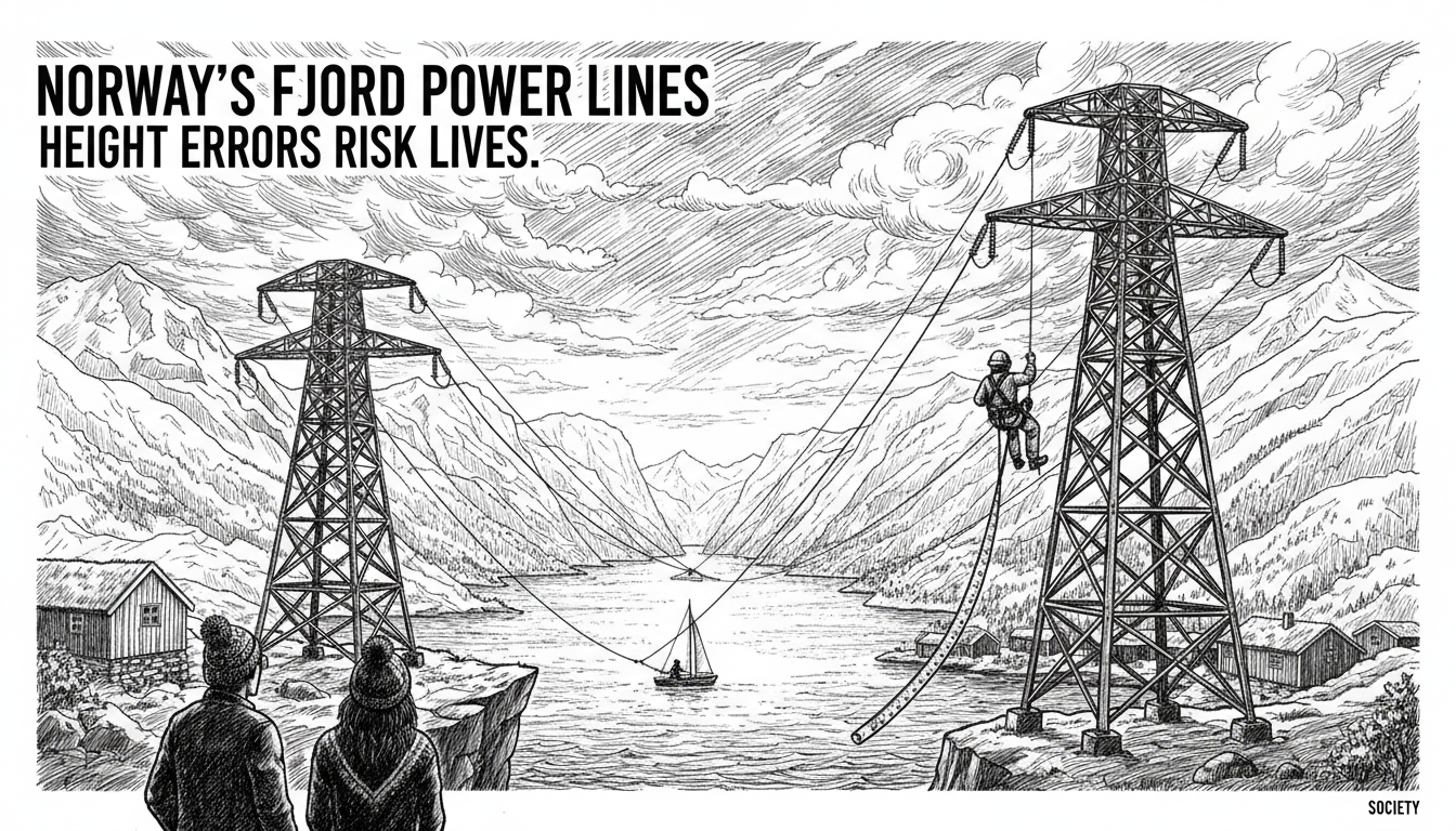
Norway's coastal authority has uncovered critical height errors in power lines spanning major fjords, creating what officials call a 'very serious' risk to maritime safety and national power security. The Norwegian Coastal Administration (Kystverket) discovered discrepancies of up to nine meters between the documented and actual heights of aerial power spans, issuing a direct order to grid operator Statnett to inspect all coastal lines and deliver a correction plan by January 15.
'The incorrect information in sea charts and faulty marking of aerial spans can pose a major risk to maritime safety and in the worst case lead to loss of life,' Kystverket stated in a formal letter to Statnett. The agency's interpretation suggests the problem could potentially affect all of Statnett's aerial spans, not just the nine already identified. This revelation strikes at the heart of Norway's complex relationship with its dramatic geography, where critical infrastructure must coexist with vital maritime corridors in some of the world's most challenging environments.
A Systemic Failure in Critical Measurements
The identified errors are not consistent in one direction. In some cases, the power lines hang up to nine meters higher than documented. In others, the clearance for vessels is eight meters lower than charted. This variability increases the danger, as ship captains and helicopter pilots cannot rely on a predictable margin of error. The nine confirmed affected fjords include some of Norway's most significant waterways: the vast Hardangerfjorden, Matrefjorden, Maurangerfjorden, and Grimstadfjorden among them.
Kystverket's investigation points to fundamental flaws in how Statnett calculates and monitors these crucial clearances. A power line is not a static piece of infrastructure. When electricity demand is high, the cables heat up and expand, lowering their sag and thus the clearance over water. Conversely, in cold conditions with heavy ice or snow accumulation, the lines can be pulled tighter and sit higher. The coastal authority believes Statnett may have significantly underestimated this thermal expansion effect on the longest spans, which can stretch for kilometers across open fjords.
'After our interpretation, this could potentially apply to all of Statnett's aerial spans, and not just those identified so far,' the agency warned, characterizing the situation as severe. This indicates a potential systemic data integrity issue within Norway's national grid documentation.
Immediate Risks to Life and Livelihood
The immediate consequence of these errors is a direct threat to maritime safety. Norway's western coastline, etched with deep fjords, is a major transport artery. Everything from local ferries and fishing boats to large commercial vessels and offshore supply ships navigate these waters. Cruise ships frequent fjords like the Hardangerfjord. Helicopter traffic for offshore oil and gas installations, search and rescue operations, and tourism also depends on accurate obstacle clearance data.
A ship's mast striking a power line could cause catastrophic damage, electrocution risk, and power outages. A helicopter collision would be devastating. The inaccuracies also undermine the official nautical charts published by the Norwegian Mapping Authority (Kartverket), which rely on data from infrastructure owners like Statnett. This erodes the foundational trust mariners place in national charting systems.
Beyond the human safety risk, the faulty heights threaten Norway's renowned power supply security. A collision severe enough to sever a high-voltage line could trigger localized blackouts or destabilize parts of the grid. Norway's electricity system, heavily reliant on interconnected hydropower, depends on these major transmission lines to balance supply across regions. Damage to a key fjord crossing could isolate communities or industrial areas, particularly along the coast where alternative routing is often impossible.
The Technical Challenge of Norway's Geography
This crisis highlights the unique engineering challenges Norway faces. Building and maintaining a national grid across a landscape of mountains, deep valleys, and fjords requires extraordinary spans. The Sognefjord power line crossing, for instance, has a main span of 4,597 meters. At such distances, environmental factors like temperature, wind, and ice have a magnified effect on cable behavior.
Professor Tore M. Undeland, a power electronics expert at the Norwegian University of Science and Technology (NTNU), explains the complexity. 'Calculating the exact sag and dynamic behavior of a long-span power line is a sophisticated engineering task. You must model the conductor's material properties, the weight of ice, wind loading, and the thermal cycle from electrical load. A persistent error of several meters suggests either flawed initial assumptions, inadequate monitoring of actual conditions over time, or a failure to update models with real-world data.'
He notes that while thermal expansion is a well-known phenomenon, its cumulative effect over decades of increasing power transmission loads may have been underestimated. 'The grid is carrying more power today than when many of these lines were built. More current means more heat, which means more expansion and lower clearance. If your monitoring isn't dynamic, you're flying blind.'
Statnett's Response and the Path to Correction
Faced with the mandatory order from Kystverket, Statnett has acknowledged the issue and begun its response. The state-owned company stated it will engage in dialogue with the coastal authority and that it is 'already in the process of quality-assuring navigation heights.' The January 15 deadline for a comprehensive correction plan is now the immediate focus. This plan must detail how Statnett will survey every aerial span along Norway's long and indented coastline—a monumental logistical task—and outline the technical and financial roadmap for corrections.
Corrections could range from the administrative—updating all nautical publications and databases—to the physical and vastly more expensive. Physical solutions might include raising support towers (where possible), replacing or tightening cables, or installing advanced, real-time monitoring systems that provide dynamic clearance data to mariners. The cost will likely run into hundreds of millions of Norwegian kroner and could impact Statnett's planned investments in other parts of the grid.
A Broader Lesson in Infrastructure Governance
This incident transcends a single technical failure. It exposes a gap in the inter-agency oversight of nationally critical infrastructure. Statnett is responsible for the power grid's operational integrity, while Kystverket is responsible for maritime safety. Their data streams and risk assessments must be perfectly aligned where these domains intersect—over every fjord. The fact that Kystverket discovered these errors, rather than Statnett self-reporting them, points to a breakdown in this alignment.
Arne F. Holm, a former director of the Norwegian Water Resources and Energy Directorate (NVE), sees a governance lesson. 'This is a classic case of siloed responsibility. The power engineer's primary concern is keeping the electrons flowing. The maritime authority's concern is clear passage. We need a mandatory, integrated risk assessment protocol for any infrastructure that crosses a navigable waterway, with joint audits and shared real-time data. The safety of human life must be the unifying parameter.'
He also points to Norway's ambitious goals for offshore wind and green industrial development along the coast. 'We are planning to fill our coastal waters with new infrastructure—more cables, more installations. If we can't accurately map and maintain the height of a simple power line, what confidence can we have in the complex digital and physical models for these future projects?'
The coming months will test Norway's ability to manage its formidable geography with the precision its people and economy demand. The order to Statnett is a first step. The true measure will be in implementing a lasting solution that ensures the majestic fjords—the lifelines of coastal Norway—remain safe passages for generations to come, with their skies clearly charted for all who travel beneath them.