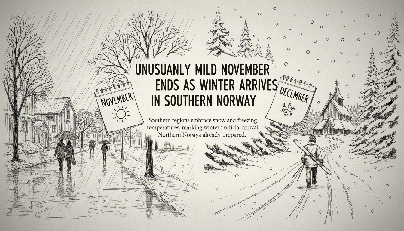
Southern Norway faces a dramatic weather shift this week. The region will transition from unseasonable warmth to winter conditions with snow and sleet expected even in low-lying coastal areas. Meteorologists confirm this change marks winter's official arrival across southern regions.
A low-pressure system brings strong winds and heavy rainfall on Wednesday. Local areas could receive between 60 and 80 millimeters of precipitation. This system signals the end of autumn-like weather patterns. Colder air from northern directions will follow, dropping temperatures toward freezing levels.
Geir Ottar Fagerlid, a meteorologist with the forecasting service, explained the transition. He said this low-pressure system concludes the extended autumn period. Winter weather will establish itself across southern Norway in its wake.
Frost becomes likely in Hordaland's lowland areas overnight Thursday into Friday. Coastal and mountain regions may experience snow showers during the same period. Eastern Norway will also turn colder though precipitation isn't expected there immediately.
Northern Norway already experiences full winter conditions. The E6 highway in Inner Troms reported slippery roads and multiple vehicles sliding off the roadway on Monday. Winter established itself in northern regions much earlier this season.
Southern Norway's November began unusually warm. Measurement stations throughout Western Norway recorded temperatures approximately 5 degrees above normal for this period. Bergen's Florida station showed particularly high readings with an average temperature of 11.4 degrees.
The warmest November ever recorded in Bergen occurred in 2011 with an 8.1-degree average. Meteorologists noted that had the warmth continued, it would have shattered previous records. Despite the incoming cold, November will likely finish warmer than normal overall.
Weather comparisons use a 30-year baseline period from 1991-2020. This current normal period reflects warmer conditions than previous reference frames. Most years now appear colder than this updated normal despite actual temperature increases.
Meteorologists use sophisticated measurement systems across Norway. Hundreds of thermometers feed data into a grid system dividing the country into one-square-kilometer sections. Statistical methods ensure all regions receive equal weighting in national forecasts.
The coming week maintains generally cold conditions with a brief mild period during the weekend. Multiple days will likely bring sub-zero temperatures, particularly overnight. Mountain areas in northern Western Norway have the highest snow probability this week.
This weather pattern demonstrates Norway's sharp seasonal transitions. The country frequently experiences rapid shifts between mild and cold periods during November. Last year's first snowfall on the West Coast occurred unusually late on November 23.
International readers should note that Norwegian winter preparedness differs from other regions. The country maintains extensive snow clearing operations and winter tire requirements. These systems ensure transportation continues despite rapid weather changes.
Norwegian meteorology employs advanced modeling that accounts for complex coastal and mountain topography. This enables accurate predictions despite challenging terrain. The country's weather service provides detailed forecasts for specific valleys, fjords, and mountain passes.