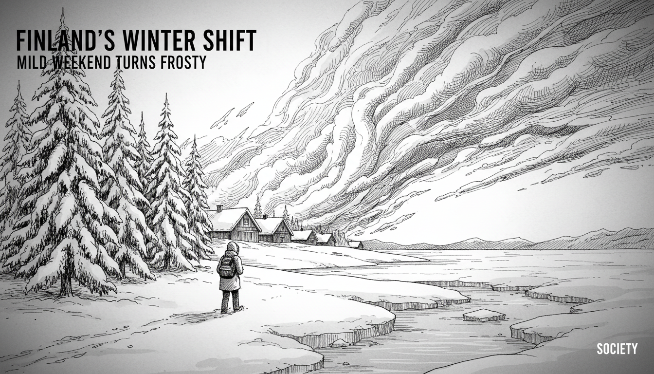
Finland's weather forecast predicts a sharp turn from mild to freezing this weekend, with significant snowfall expected in Lapland. The Finnish Meteorological Company Foreca detailed the shift in its latest forecast, outlining a rapid transition that will see temperatures plunge below zero across most of the country by Sunday. This sudden change highlights the dynamic and often unpredictable nature of Finland's winter climate, where conditions can shift dramatically within hours.
Foreca's analysis indicates a cloudy Saturday for most of the country, with drizzle and rain moving into southern and central regions on a mild southwesterly wind. Temperatures will remain above freezing, reaching around +7°C in the south. However, the situation reverses decisively on Sunday. The mild winds will retreat, replaced by a cold air mass flowing from the north. This will cause plus temperatures to drop below zero, bringing frost to most regions. Scattered showers of rain, sleet, and snow will move across the land, with snowfalls anticipated in northern and eastern Finland.
A Weekend of Two Halves
The contrast between Saturday and Sunday serves as a classic example of Finland's meteorological volatility. "The defining feature of our weather, especially in transitional seasons, is the speed of change," explains a senior meteorologist at the Finnish Meteorological Institute. "We sit at a crossroads of air masses. A shift in wind direction can replace Atlantic mildness with Arctic cold in a very short time frame." This weekend, that shift is particularly pronounced. While southern Finland enjoys relatively mild conditions on Saturday, Lapland is already experiencing winter's grip with snowfalls of around five centimeters predicted for central and northern parts of the region.
The initial mild phase is driven by a low-pressure system drawing warmer air from the southwest. This is a common pattern that can bring brief thaws, known as 'talvikevät' or winter-spring, even in mid-winter. However, the blocking high-pressure system over Scandinavia and Russia is poised to reassert itself, funneling colder air southward. This battle between air masses creates the unstable conditions forecast for Sunday, with precipitation types changing rapidly depending on local temperature nuances.
Lapland Braces for Fresh Snow Cover
In Lapland, the forecast is squarely focused on winter conditions. Snow is expected from Friday night into Saturday, with some initial uncertainty about whether it will fall as snow or rain in the southern parts of the region. For central and northern Lapland, the precipitation will be snow, adding approximately five centimeters to the existing snowpack. This is crucial for the region's tourism and ecosystems. A consistent, deep snow cover insulates the ground, protecting tree roots and subnivean animal life, and forms the foundation for winter sports.
"For Lapland, these early winter snowfalls are vital," says a tourism development manager based in Rovaniemi. "They establish the winter landscape that visitors expect and allow for the opening of ski resorts and other seasonal activities. A sudden warm spell followed by a freeze, like this one, can create a hard crust on the snow, which is challenging for reindeer herding as the animals struggle to dig for lichen." The forecast suggests snow may push southward toward the beginning of the Christmas week, potentially bringing the first proper winter blanket to southern coastal cities.
The Hazards of a Rapid Freeze
This specific weather pattern—mild and wet followed by a sharp freeze—presents distinct public safety and infrastructure challenges. Rain and drizzle on Saturday will leave roads and pavements wet. When temperatures plummet overnight into Sunday, that moisture will turn to ice, creating widespread slippery conditions. The Finnish Transport Infrastructure Agency typically issues warnings for such events, advising motorists to exercise extreme caution and switch to winter tires, which are legally mandatory in Finland from December to February.
Municipal road maintenance crews across the country will be on high alert, ready to deploy salt and gravel to improve traction. For pedestrians, the risk of slips and falls increases significantly. Furthermore, the fluctuating temperatures around the freezing point cause snow to melt and refreeze, leading to heavy, wet snow loads on trees and power lines. This can result in localized power outages if branches snap. The Finnish Energy industry association monitors such weather closely, as ice accumulation on power lines is a known risk during these transitional periods.
Climate Context and Long-Term Trends
While a cold weekend in November is entirely normal for Finland, these individual weather events occur against a backdrop of long-term climate change. Finland's annual average temperature has risen by more than two degrees Celsius over the past 170 years, a rate faster than the global average. Winters are warming particularly quickly. The number of frost days has decreased, and the snow season has shortened, especially in the southern parts of the country.
"We are observing a trend toward greater variability and intensity in weather patterns," notes a climate researcher at the University of Helsinki. "What we might see more often are these 'rollercoaster' events—very mild periods followed by returns of intense cold. The warming Arctic may be contributing to more persistent weather patterns, like the high pressure that brings us cold spells, which can sometimes stall for longer periods." This means while winters are getting milder on average, the potential for severe cold snaps and heavy snowfall events during winter remains, albeit within a warmer overall climate framework.
Preparing for the Finnish Winter
For residents, this weekend's forecast is a clear signal to finalize winter preparations. The shift acts as a practical drill for the season ahead. It underscores the importance of having appropriate clothing—layers that can be adjusted for changing conditions—and ensuring vehicles are equipped with proper winter tires. Homeowners check their properties for adequate insulation and ensure heating systems are functioning optimally ahead of the deeper cold expected in the coming months.
For authorities, it tests the responsiveness of winter maintenance protocols. The efficiency with which roads are cleared and treated during this first significant transition of the season provides valuable data for the months ahead. The weather also impacts energy consumption; a sudden drop in temperature leads to a spike in heating demand, which power grid operators must balance. Finland's energy system, with its significant share of nuclear, hydro, and now wind power, is designed to handle these peaks, but weather forecasts are a critical tool for managing production and imports.
Looking Ahead to the Christmas Week
The Foreca forecast hints at a potentially white start to the Christmas period, with snow showers possibly reaching southern Finland in the early part of the holiday week. This prospect is always met with anticipation, as a snowy landscape is deeply ingrained in the Finnish Christmas ideal. However, the reliability of a white Christmas has decreased in Helsinki and other southern coastal areas due to the warming climate. Statistically, the likelihood is now around 50-50 in the capital region, compared to near certainty in the early 20th century.
In Lapland, snow at Christmas is virtually guaranteed, making this weekend's top-up snowfall welcome news for the holiday tourism season. The fresh snow will refresh the landscape, cover any bare patches, and improve conditions for skiing, snowmobiling, and other winter activities that are the cornerstone of Lapland's economy during the darkest months of the year. The cold, crisp air that follows the weekend freeze is also ideal for one of Finland's most magical winter phenomena: the appearance of vibrant Northern Lights, which become more frequent and visible as solar activity increases toward the peak of its 11-year cycle.
This weekend's sharp turn in the weather is more than a simple change in temperature. It is a demonstration of the powerful forces that shape Finland's climate, a test of societal readiness for winter, and a reminder of the deep connection between weather and daily life in the North. As the light fades and the cold strengthens, the country adjusts its rhythm, proving once again its resilience and preparedness for whatever the Arctic winter brings.